V 5.8 - A minor fix for the upgrade routine.
V5.6 - You can now zoom in on the tide curves and graphs (for pro users), very practical!
+ Some minor bug fixes and code modernizations.
V5.5 - We fixed some minor bugs, thanks for reporting!
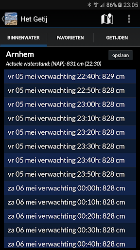
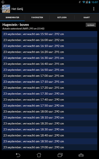
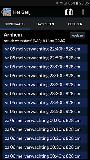
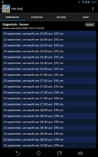
V5.4(.1) - The app is equipped with eleven inland water measuring points in Groningen in Friesland, namely: Slochtersluis-upper, Oostersluis Groningen, Dorkwerd, Gaarkeuken-East, Gaarkeuken-West, Eibersburen, Burgumerdaam-Boezem, Terherne- Boezem-East side, Terherne-Boezem-West side, Lemmer-Boezem and Lemmer-IJsselmeer.
+ Some optimizations in the data representations and modernizations in the program code.
V5.3 - It is now again possible to start Zeeweer, the Tidal Stream Atlas and Water Map Live directly from this app.
V5.1 - Some minor bug fixes and upgrades, including widgets and pro features.
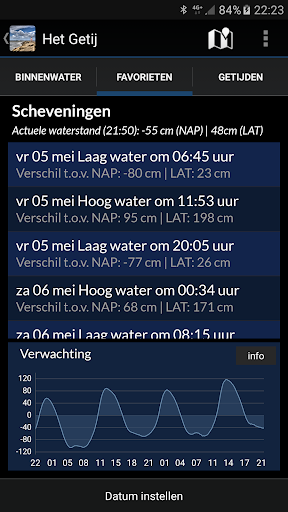
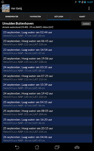
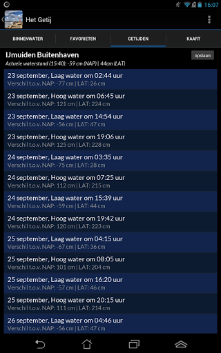
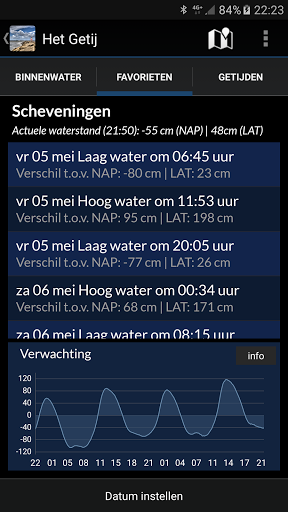
V4.8 - You can now view the tide graphs both in NAP and against LAT - the Lowest Astronomical Tide - (pro). We've also made some bug fixes and minor layout improvements. Thanks for reporting!
V4.7 - The app's code has been modernized a lot, and we've made some minor bug fixes, thanks for reporting!
V4.5 -All tidal stations in Zeeland, around Rotterdam and in Noord-Holland are now working properly again + fix for the dark theme on Android 10 and higher.
V4.4 - Some bug fixes in the code (thanks for reporting!)
V4.3 - You can now again start the Tidal Stream Atlas from the menu.
V4.1- The code of the app has been modernized, and we have fixed some small bugs. Thanks for reporting!
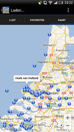
V4.0 - The water map now works on all devices again, and has been expanded to include all inland water level measurement points.
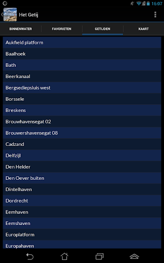
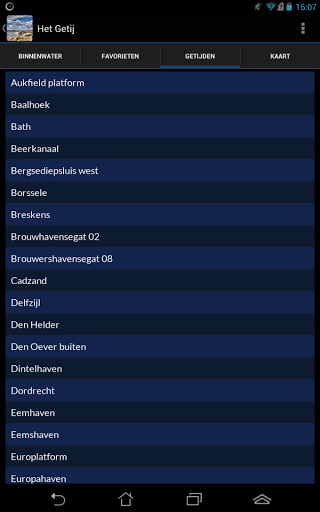
V3.9 - The number of inland water level measuring points has now been expanded to 116. You will find these in the Inland Waterways tab on the left.
V3.8 - The details window with high and low water times and heights now looks better readable if you have set the font on your phone larger.
V3.7.1 - Bug fixes for both widgets, they are doing it again right now. Thanks for reporting!
V3.7 - Bug fixes for both widgets, they are doing it right now. Thanks for reporting!
V3.6 - Some bug fixes and minor technical improvements to the program code.
V3.5 - The app is now updated with the tide tables until the end of 2019.
+ Tide measuring point Holwerd has now been added.
+ You can now start our new Waterkaart Nederland app directly from the menu.
V3.4 - On modern, large devices the app now looks completely right again + the notification that the app has been upgraded is now a one-off.
V3.3 - Some minor bug fixes in the program code + fix in the subscription system for pro users.
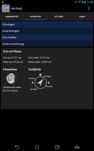
V3.2 - The default installed favorites are now working properly again. V3.1 - The Maasvlakte is now also a surveyable measuring point + the current water level and tidal curve of Sint Annaland have been added. V3.0 - The tide tables are now updated until the end of 2018 + we have added a number of new tide stations: the Princess Amaliahaven and Tennesseehaven (Maasvlakte), the Rozenburgsesluis zuidzijde (the lock between the Caland Canal and the Hartelkanaal) and Sint Annaland.
V3.1 - The Maasvlakte is now also a surveyable measuring point + the current water level and tidal curve of Sint Annaland have been added. V3.0 - The tide tables are now updated until the end of 2018 + we have added a number of new tide stations: the Princess Amaliahaven and Tennesseehaven (Maasvlakte), the Rozenburgsesluis zuidzijde (the lock between the Caland Canal and the Hartelkanaal) and Sint Annaland.
V2.9.1 - The widget for pro users is now doing everything as it should.
V2.8 / 9 - A few small adjustments for the tide graph (in the pro version) + various bug fixes in the program code.
V2.6 - Bug fixes for both widgets, for a crash on older Android tablets + for the notification that there is no internet, if there is a connection.